Case Study: Wind Turbines
The USGS maintains a wind turbine database at its website https://eerscmap.usgs.gov/uswtdb/.
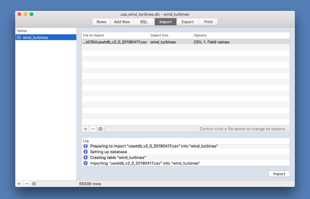
The release from April 24, 2019 was used in this case study. It included data on 59,338 turbines covering 43 states (plus Guam and PR).
The first step after downloading the raw data in CSV format from here and uncompressing it was to drag and drop the downloaded CSV file into the Import Console in General DB and import it. The Import Into table was changed by double-clicking the item in the Import Console, and the first line was changed to "Field Names" by right-clicking the item.
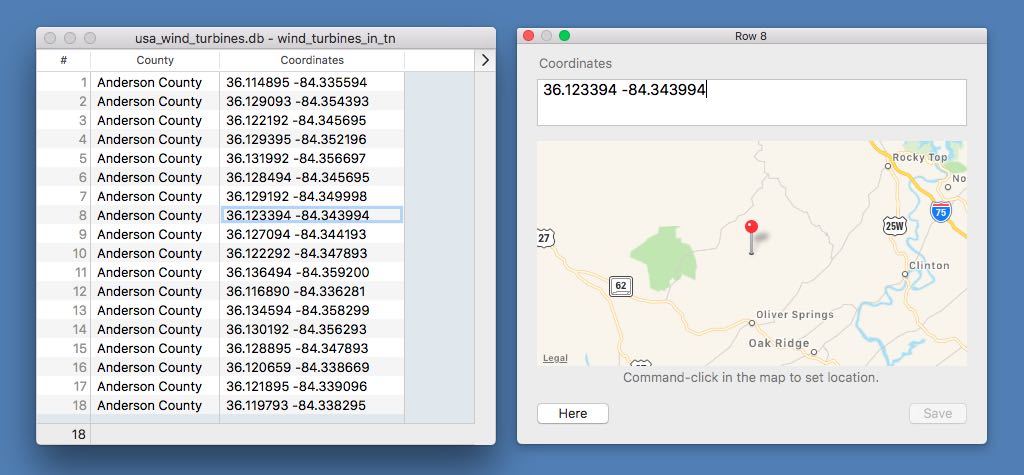
To find the wind turbines in Tennessee, a view was created using the following SQL in the SQL Console. Then the Name and Fields panel was modified by right-clicking on the view in the Rows Console and the Coordinates field format was changed to Location so that we could Command-double-click on a location to see it in a map view.
CREATE VIEW wind_turbines_in_tn AS

    SELECT t_county AS County, ylat || ' ' || xlong AS Coordinates

    FROM wind_turbines

    WHERE t_state = 'TN'
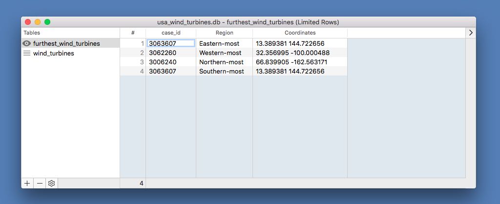
To see the wind turbines that are the furthest away from the country, the following SQL was used.
    CREATE VIEW furthest_wind_turbines AS

    SELECT case_id, "Eastern-most" AS Region, ylat || ' ' || max(xlong) AS Coordinates FROM wind_turbines

    UNION ALL

    SELECT case_id, "Western-most", ylat || ' ' || min(xlong) FROM wind_turbines

    UNION ALL

    select case_id, "Northern-most", max(ylat) || ' ' || xlong FROM wind_turbines

    UNION ALL

    SELECT case_id, "Southern-most", min(ylat) || ' ' || xlong FROM wind_turbines